Walks in North Uist
Eaval
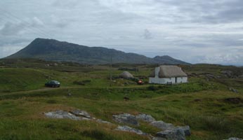
If two cars can do walk from Knoc-cuien, start at
thatched cottage and follow path across moorland heading for ridge of Eaval
at 898595,
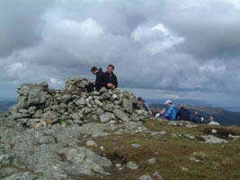
then head north to summit, false cairn first, then
summit.
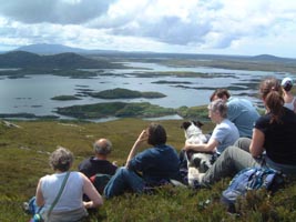
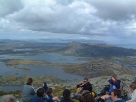
On a good day fantastic views.
Can return by steepish descent to the eastern end
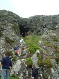
of Loch Obisary. Short detour to see cave at 917614.
Then back round shore of Loch Obisary , follow path
to finish at Sidinish. About 6 hours.
If one car best approach from Sidinish.
Vallay
Check tides before doing this. If you have a tent
and tides are right you can camp on the island. Beautiful beaches on the
north side of the island. Can start from the cottage, will have to cross
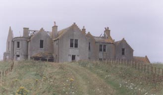
a few fords but none more than about 18 inches deep. Head for Erskine Beveridges
house, now a ruin and unsafe to enter.
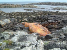
This year (2004) large pilot whale dead among rocks
just at Camas Mor.
Malaclate Machair and Traigh Iar
Can walk from cottage or park car at foot of road
to machair. Possible to cycle most of this but depends on tide, best if
out and weather (not too windy). Head for 796759 either along track or
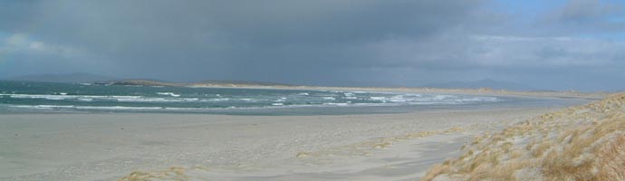
beach, then along Traigh Iar, three miles of unspoilt silver sands with
usually no-one on it.
Can walk to end and come back either along tracks
or retrace steps. Can cut up to Co-op.
Aird a Mhorain
This is a great walk, possibly may see otters and
seals. Park at Grenitote near beach. It is possible to cycle along a large
part of this walk. Head along Traigh Ear , cut over spit of land at Corran
Aird a Mhorain, follow this beach round. Look for cross mark on rock where
beach ends. Follow path to cemetery of Macleans of Boreray. Head around
point, there are definitely otters here., follow the bays on the west back.
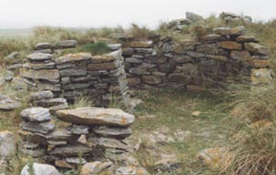
Roundhouse at Udal has been excavated and is worth
seeing. Cut back to Traigh Ear and back to starting point.
Natural Arches at Scolpaig
Start at Scolpaig Farm, can park just beyond the
farm. Head north following path/coast. Be careful steep edges which can
be slippery. Arches about a kilometer from farm. Arches are very impressive.
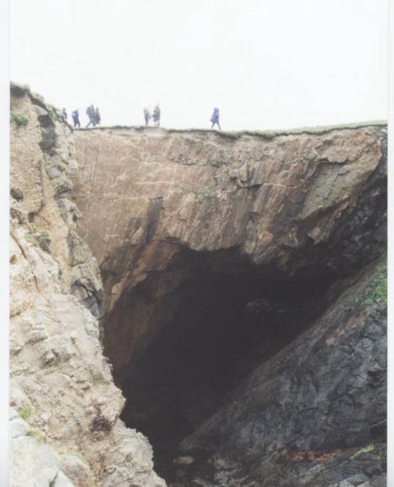
Lots of birds especially fulmars and auks. Can continue
to walk round coast to bay just before Callernish and head back to Scolpaig
over Ben Scolpaig
Sgurr an Duinn
Easy walk. Start at crossroad at Middlequarter,
Sollas. Head south up road for about a mile then west to summit. Remains
of observation post. Good views out to north and west. Can see Flannan
Isles on a good day.
Balranald Bird Reserve
Start at Wardens hut at Hougharry, follow path heading
south west then west to beach at Traigh Iar .Can either head north round
Aird an Runair and along Traigh nam Faoghailean and back to hut or
head south along Traigh Iar and then to Port Scolpaig. Head back either
by retracing steps or following paths at back of dunes.
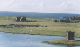
Newton Ferry
Start at lay by at Loch an Sticir. Can explore Dun
an Sticir , head for Loch Iosal an Duin, then head around side of Beinn
Bhreac heading for Bealach na Beinne and then back to Dun an Sticir. Lots
of evidence of ancient settlements. Lots of birds.
Clachan Sands
Follow road down to graveyard, can continue along
this until get to shore. Lovely beach. Can walk along beach as far as you
like but will have to retrace steps.
Paible
Start at Kyles Paible, head to beach, nice walk
along beach, can head back at a variety of points along roads or again
can retrace steps.
Beinn Mhor Group in South Uist
Although only Beinn Mhor exceeds 2,000ft , this
walk which includes Ben Corodale and Hecla, the second and third highest
hills on the island, requires a certain degree of fitness. Begin on the
A865 at the first passing place south of the bridge over
the Abhainn Roag. Follow a Land Rover track up onto
the moor, then
make for the shoulder of Maola Breac .. Continue
up the shoulder of Beinn Mhor
to reach the north-west top at the rim of Glen Hellisdale.
An attractive, narrow half mile ridge leads to the main summit. To the
west is the Atlantic and you may see the weather sweeping in , to the east
are Skye,the Inner Hebrides and the mainland. Below is
Corodale Bay, where the young pretender, Bonnie Prince
Charlie hid from the Redcoats before
Flora Macdonald, who was born on South Uist, helped him escape. The 'Prince's
Cave' is marked on the OS map.
Return along the ridge to the north-west top. Then
descend eastwards from Beinn Mhor's northern shoulder to the Bealach Hellisdale
and then head up the steep slope to the rocky summit of Ben Corodale
avoiding the crags.
Head north over the top, avoiding the crags, then
a long descent and then another steep ascent up the south face of Hecla.
Head down the west ridge and back across the moor to the road.